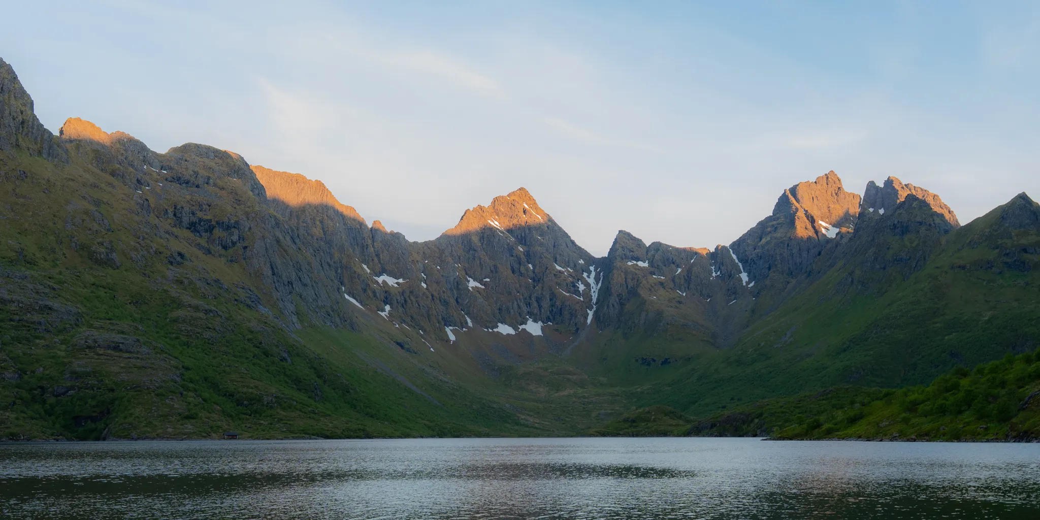
West Side of Moskenes
Overland attempt from Å to Hellsegga via Ågvatnet Pass, aiming for the remote western tip of Lofoten. Turned back at Steinberget due to the tides.
The Long Crossing ends at Å, a village whose name is the last letter of the Norwegian alphabet. A local on Bunes beach explained to me that the village got its name because it sits at the end of the road. But Å isn’t the end of Lofoten. Beyond it, past Ågvatnet Lake and over the mountains, the island keeps going to Hellsegga, where the land finally drops into the sea above the Moskstraumen maelstrom.
After completing 60 miles of the Long Crossing from Fredvang to Å over four days, I convinced my friends to do a “day hike,” off trail, over an unnamed pass to reach that true end. What I meant by “day hike” was not a couple-mile out-and-back but 24 full hours of hiking. My dream was to complete this 20-mile round-trip traverse, reach the top of Hellsegga, and watch the midnight sun dip toward the horizon over the maelstrom, knowing we had walked to the true end of Lofoten.
The trip involved an approach on maintained trail around Ågvatnet Lake, a game trail to an unnamed pass (from here on called Ågvatnet Pass), a steep, V-shaped scree couloir to top out on the pass, a steep descent to Gjerdvika beach, a traverse along the beaches, a crossing of the Gongskardet rockfall, and a final ascent up the Hellsegga plateau.
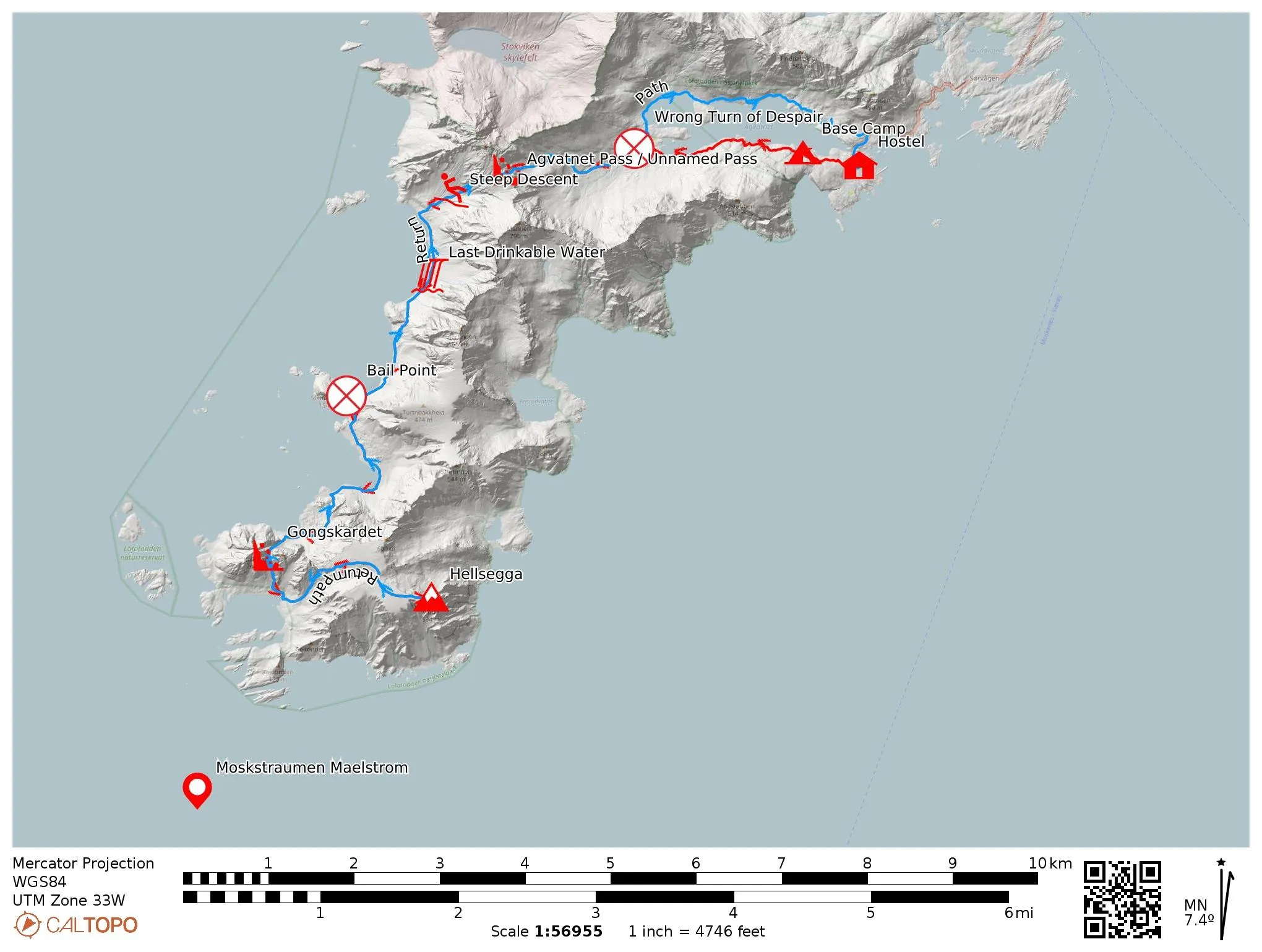
Due to tidal conditions, we got cliffed out near Steinberget, a large headland, and decided to turn around due to fatigue and safety. Other beta I reviewed documented traverses in the opposite direction: a water taxi to Hellsanden, the beach below Hellsegga, then a return on foot to Å. [INSERT BETA LINK] That beta identified the Gongskardet rockfall, which occurred sometime in 2025, as the unknown crux of this traverse. Since we turned around before reaching the rockfall, its current state is still unknown.
Basecamp
It’s the start of June, so the sun doesn’t set this far north. After reaching our car at the end of the Long Crossing, we drove around mindlessly until about 2 am, seeing the sights and looking for somewhere to sleep. We live the vagabond life, so we’d rather sleep in a ditch than spend the money on a hostel.
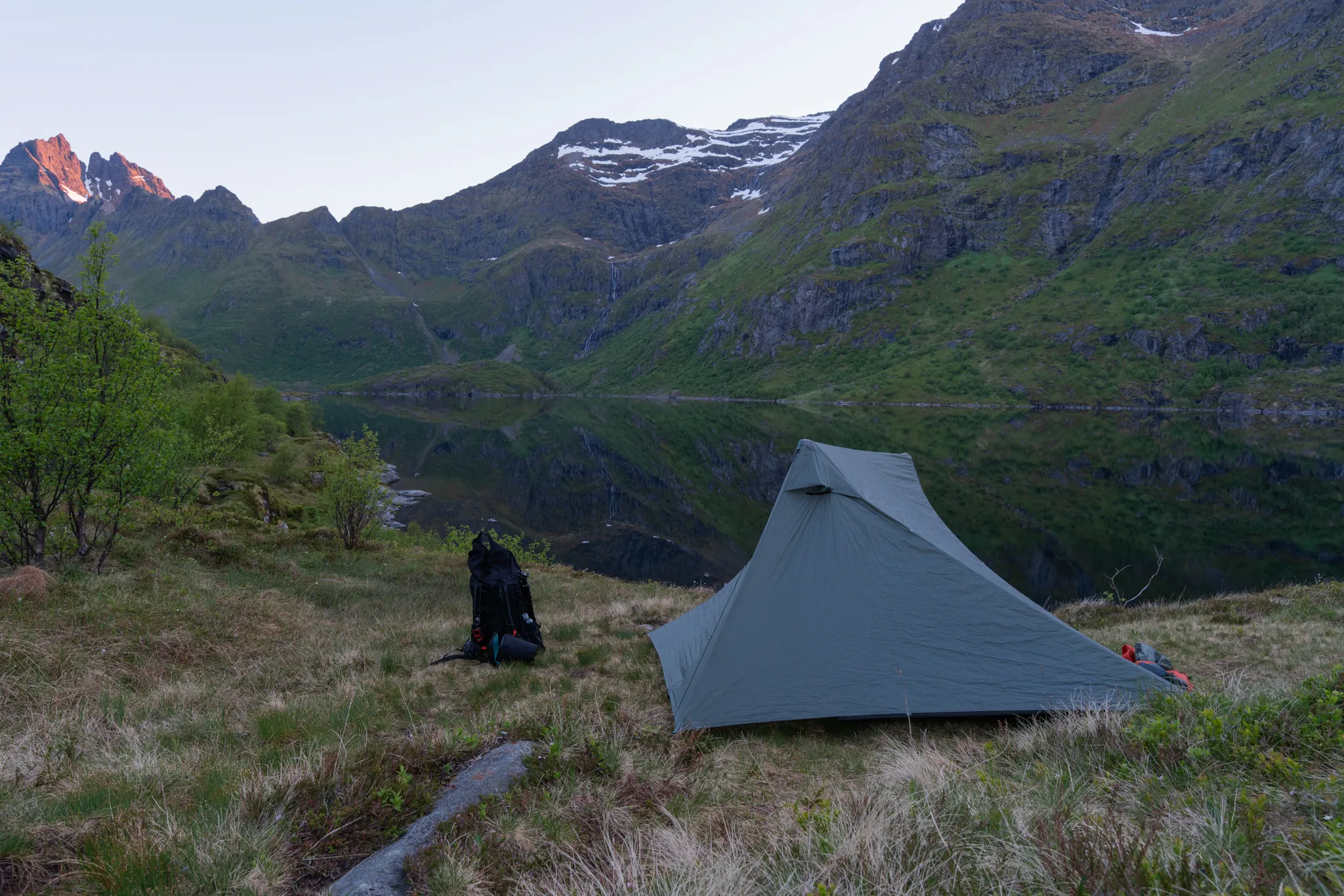
After convincing my friends (minus one who twisted his ankle during the Long Crossing) to do the day hike, we set out to make camp near Ågvatnet Lake. After a short 0.4-mile hike, we found a serenely quiet spot to set up for the night.
Approach to Ågvatnet Pass
After a short rest, we left behind non-essential items (tent, extra food, any clothes beyond our bivouc layers) and navigated around Ågvatnet Lake on maintained trail. Over the course of the Long Crossing, we learned that “well-maintained” trail by Norwegian standards still means knee-deep mud and slick rock. The trail markers end near the northern inlet creek of Ågvatnet Lake. From there, we navigated by satellite GPS track and eventually turned onto a game trail that led us up to a small basin below Ågvatnet Pass.
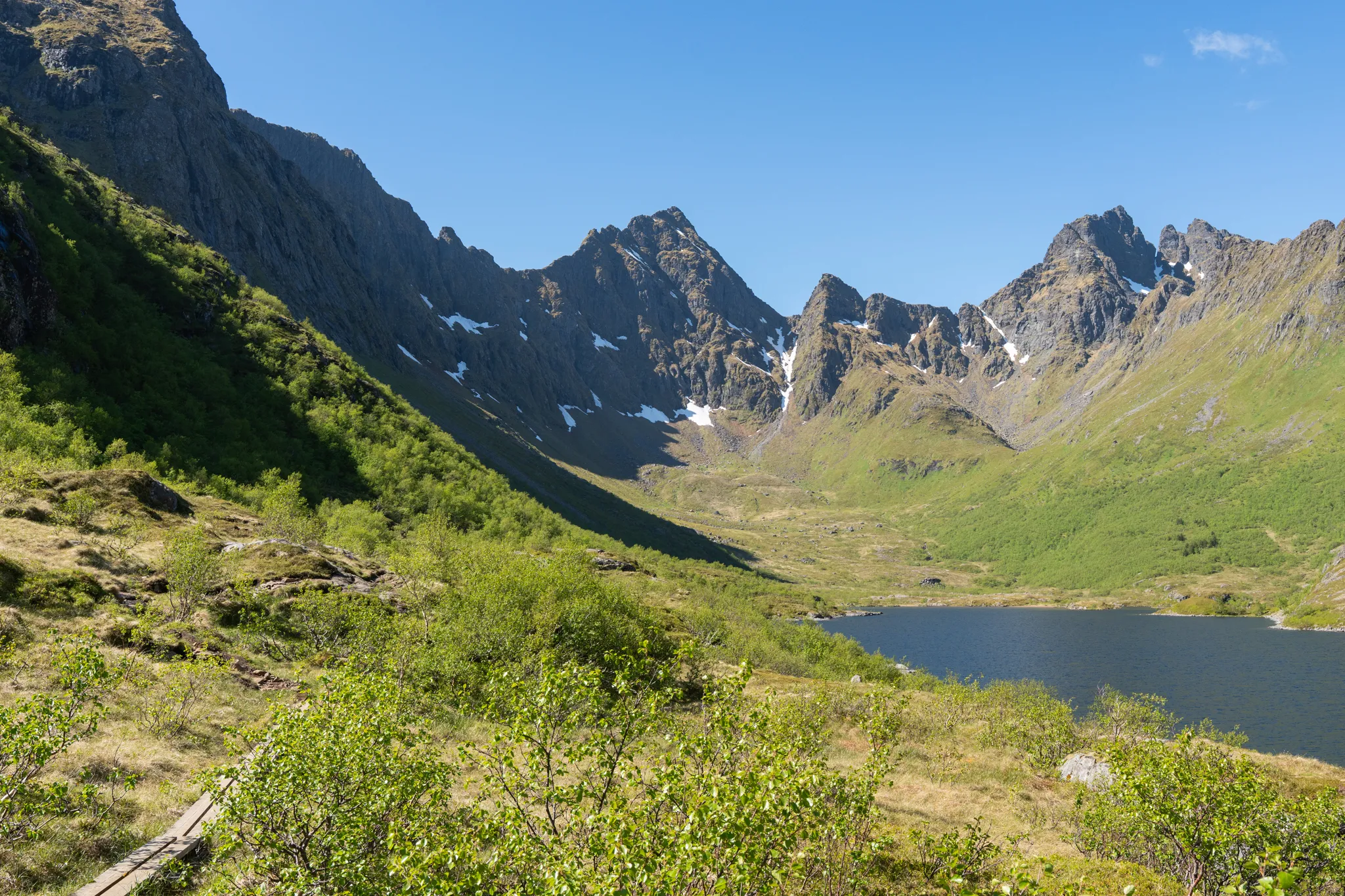
Ågvatnet Pass
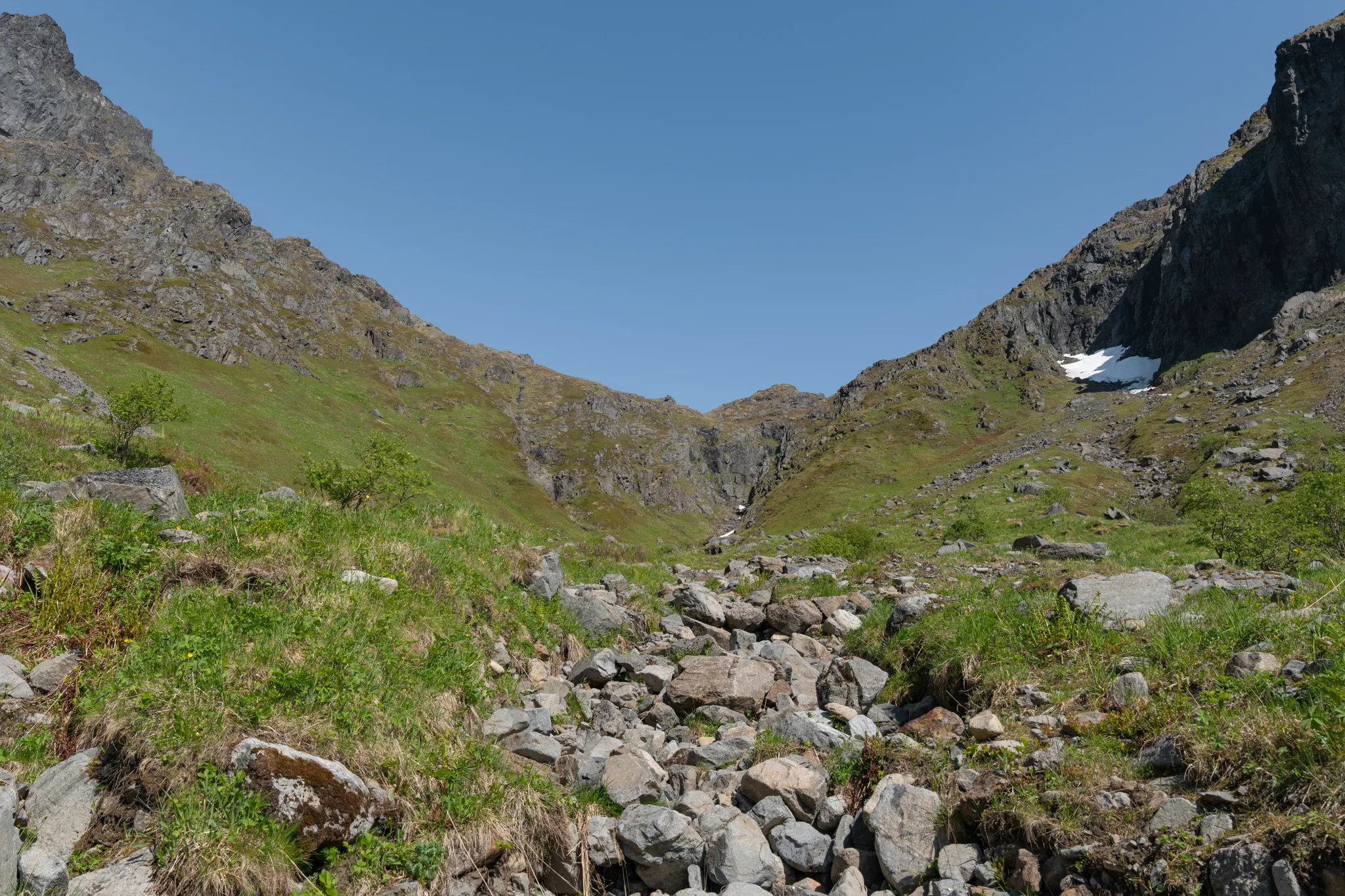
Standing below the pass and looking up at the cliffs above, it’s clear this pass and the surrounding terrain are highly dangerous. In hindsight, a helmet, harness, and static rope would be necessary. Surrounding the pass is a talus field from previous rockfalls. The boulders range in size from small head-sized to large car-sized. Many are not covered with lichen, indicating the rocks fell recently, likely in the previous snow season. As it was early June, just turning into summer, this was highly alarming. A go/no-go decision we made as a team was that if we witnessed a rockfall, we would bail and descend back to town.
The pass slopes upward and then turns into a steep, ~40-degree couloir with a base of loose scree, flanked on both sides by about 100 feet of loose, rocky cliff. The couloir is approximately 300 feet high. Since we were early in the season, a small snowbank still hugged the bottom of the couloir for approximately the first 100 feet. The snow was water ice at this point, and a fall would not be arrestable with an ice axe.
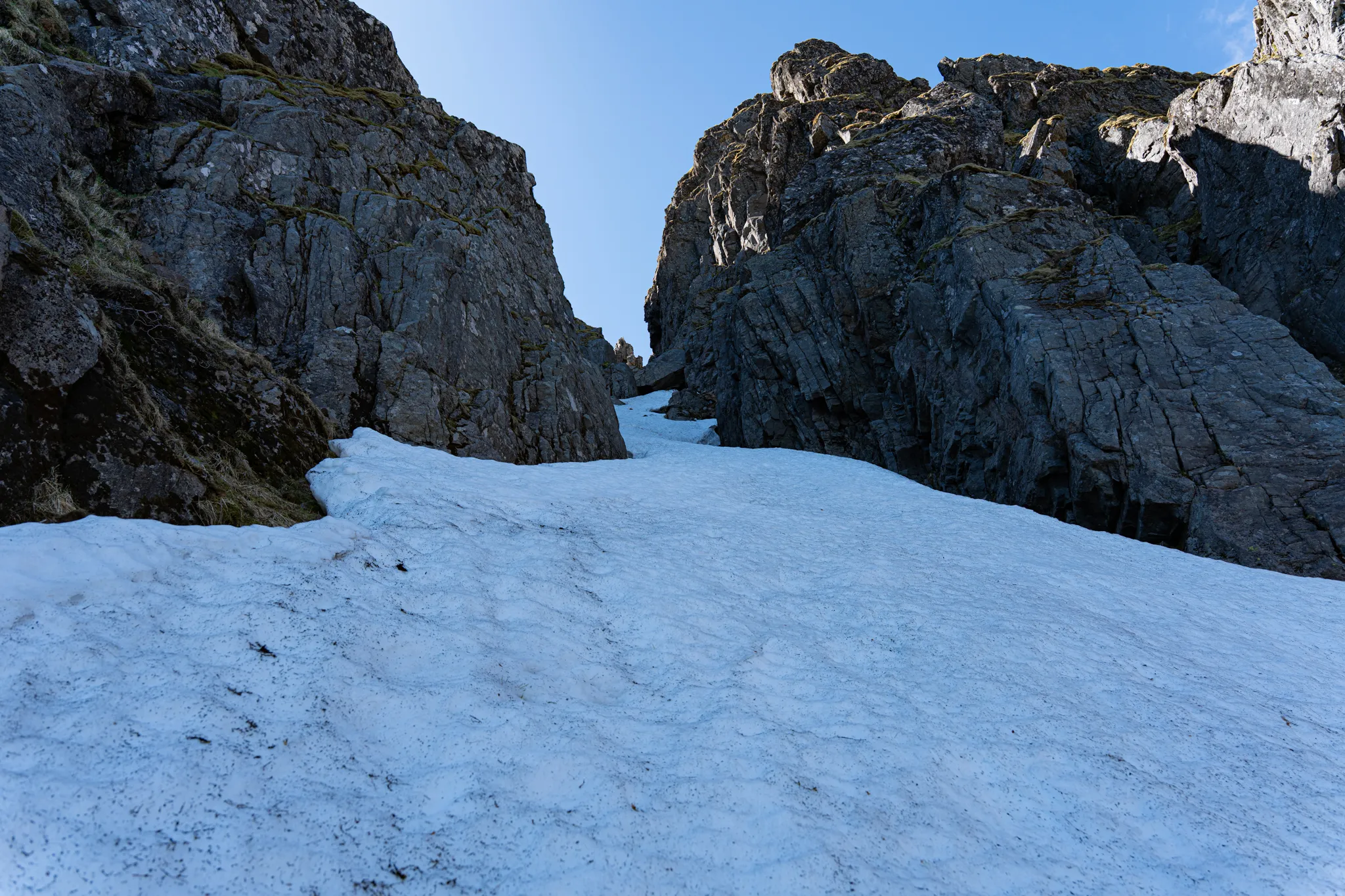
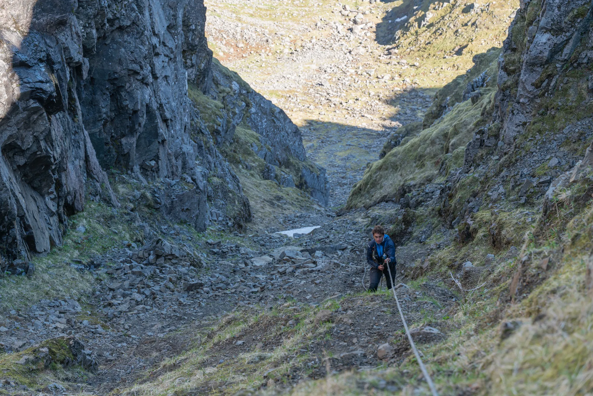
We hugged the moat (randkluft) along the side of the snowbank to clear the first 100 feet, then scrambled up the scree-lined couloir, taking turns while the others waited behind cover to avoid kicking rocks onto each other. The last ~60 feet of the couloir is very steep, >45 degrees. Luckily, there is a fixed rope. At the time of our traverse, the rope was in good condition, only slightly sun-bleached. On the ascent this rope is not necessary, but it is required to rappel on the descent. This is another go/no-go condition. Since we assessed the rope as in good condition, we continued over the pass. If you are attempting this in the future, please bring rope and cord for rappelling. For anchors, there are numerous horn features along the sides of the couloir.
The West Side of Moskenes
The top of Ågvatnet Pass boasts one of the most breathtaking, remote, and pristine views in all of Norway.
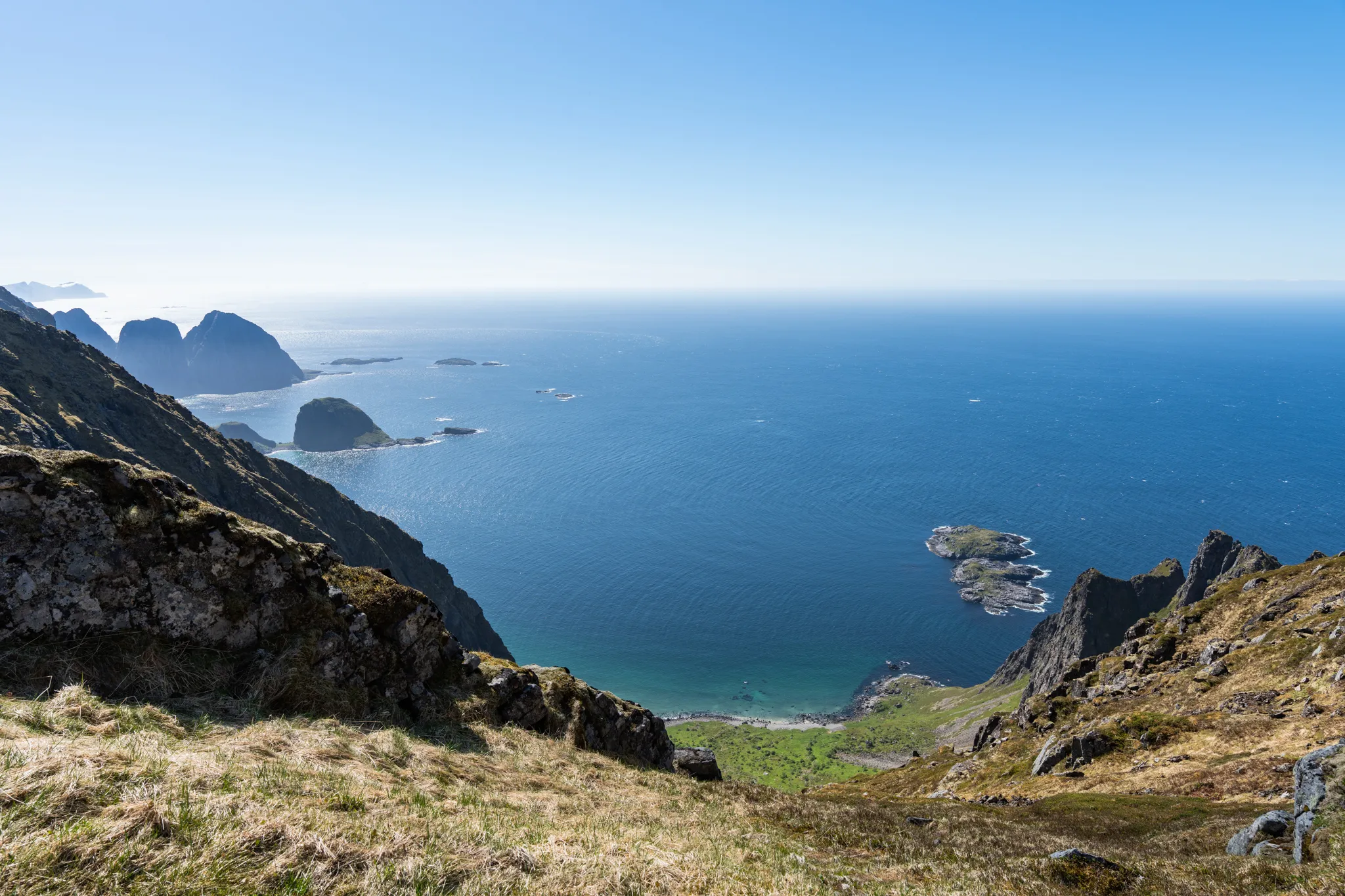
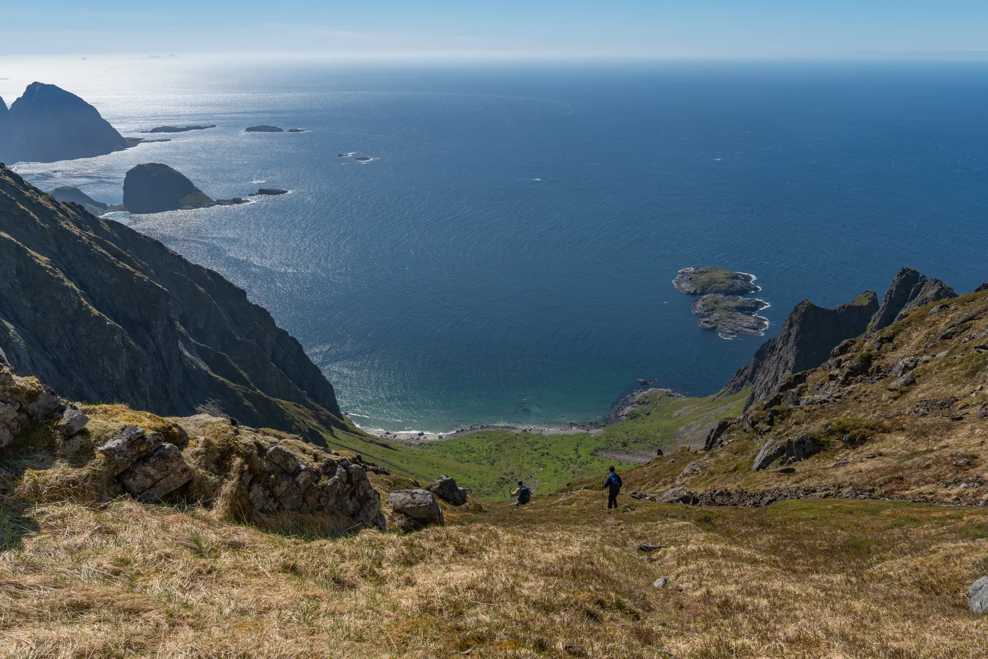
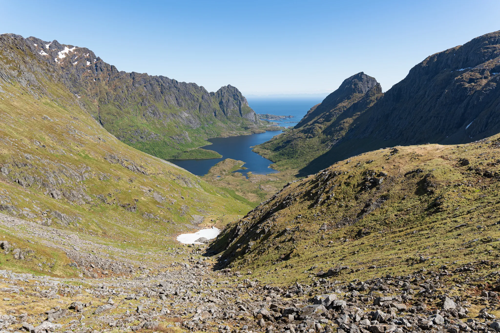
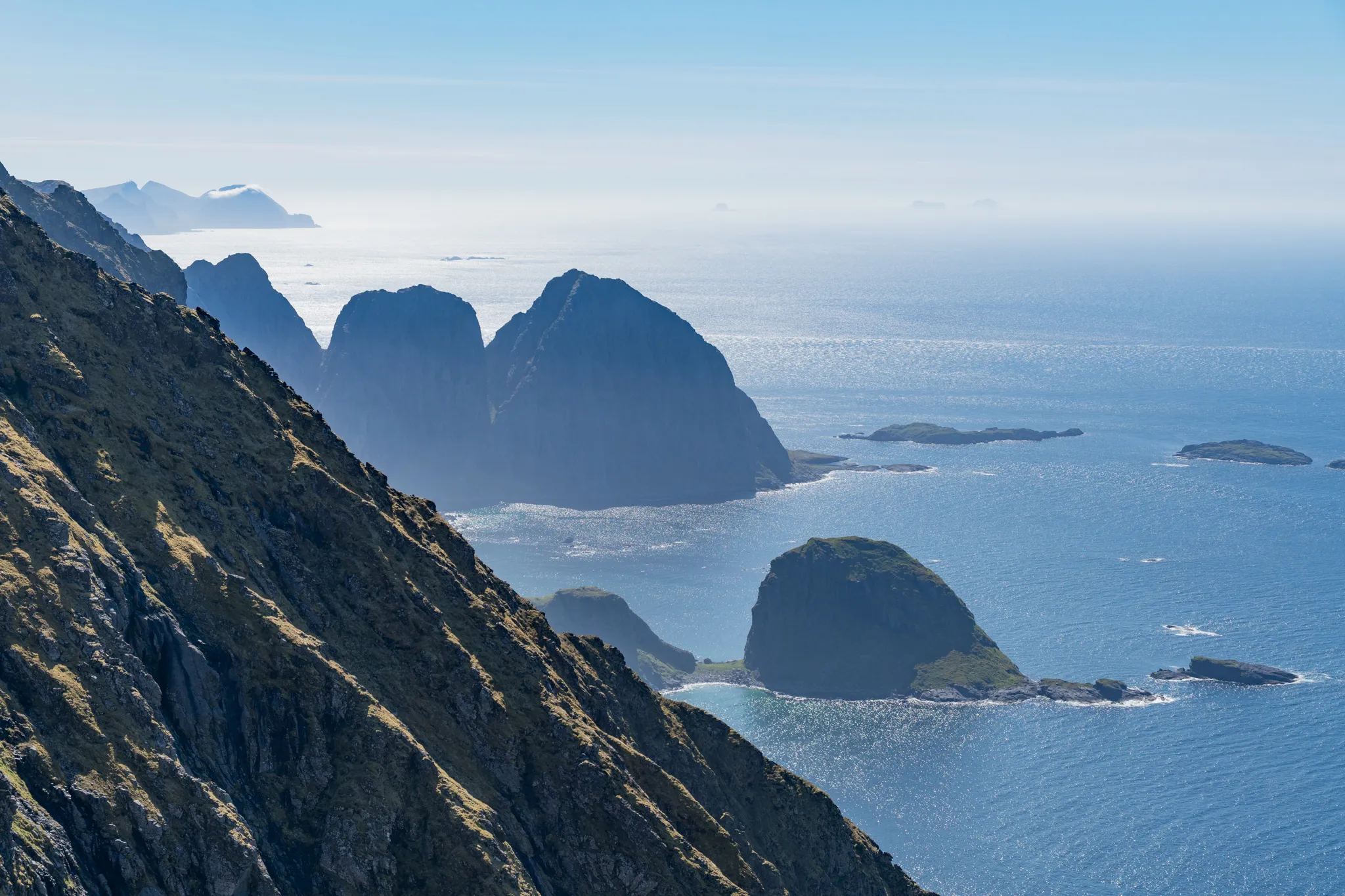
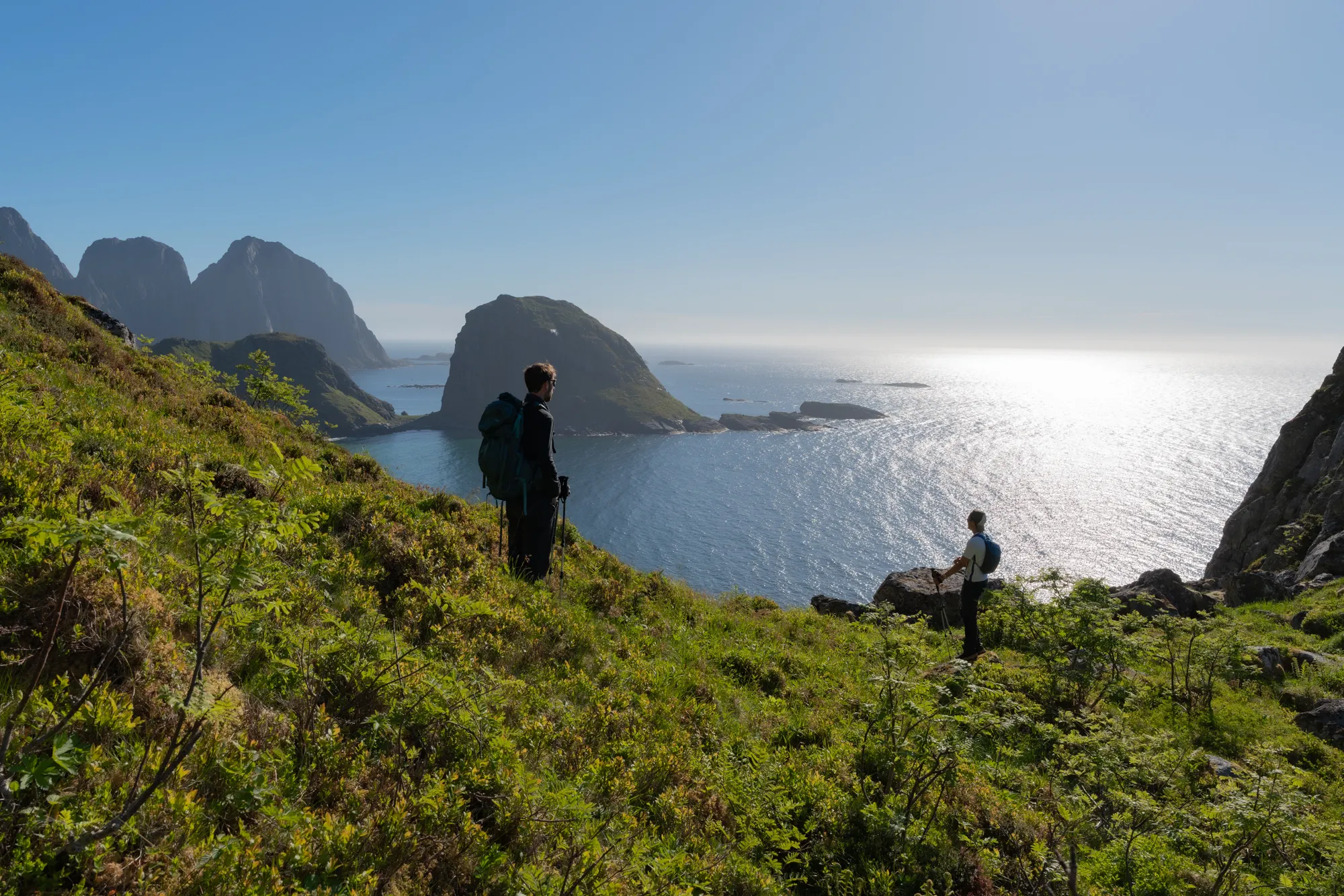
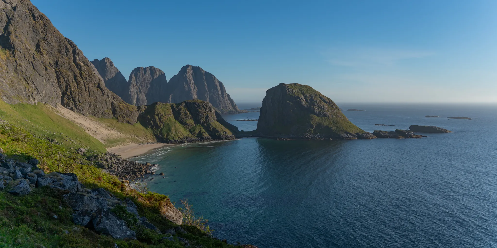
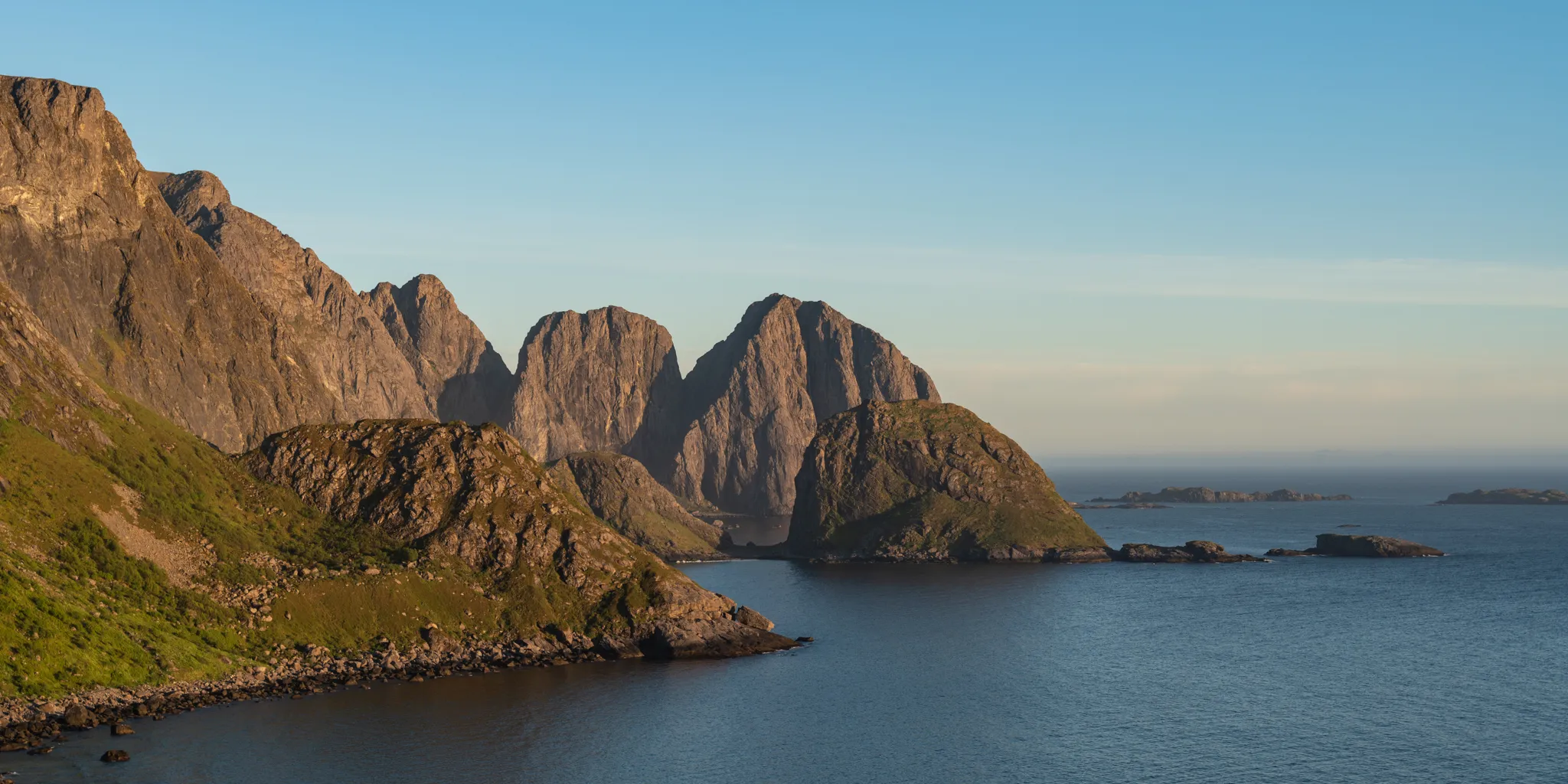
From our vantage point approximately 2,000 feet above the ocean, we could see as far as Værøy off the coast of Lofoten, far into the Arctic Ocean, all the way to Gongskardet, and down a steep 2,000-foot descent to the white-sand beach below us.
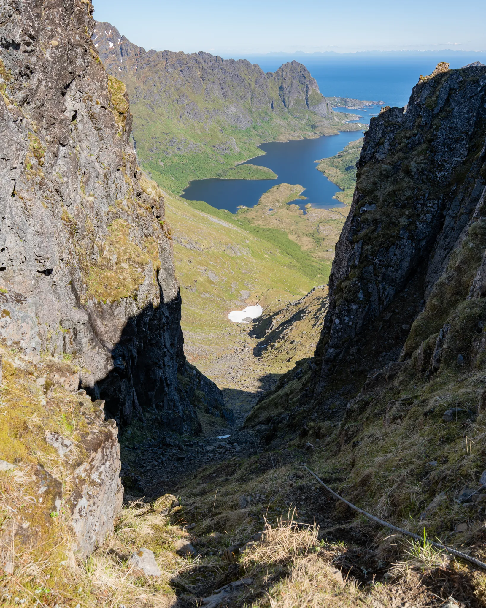
Looking backward, we could see down the steep couloir, across Ågvatnet Lake to the town of Å, and even to the coast of the mainland.
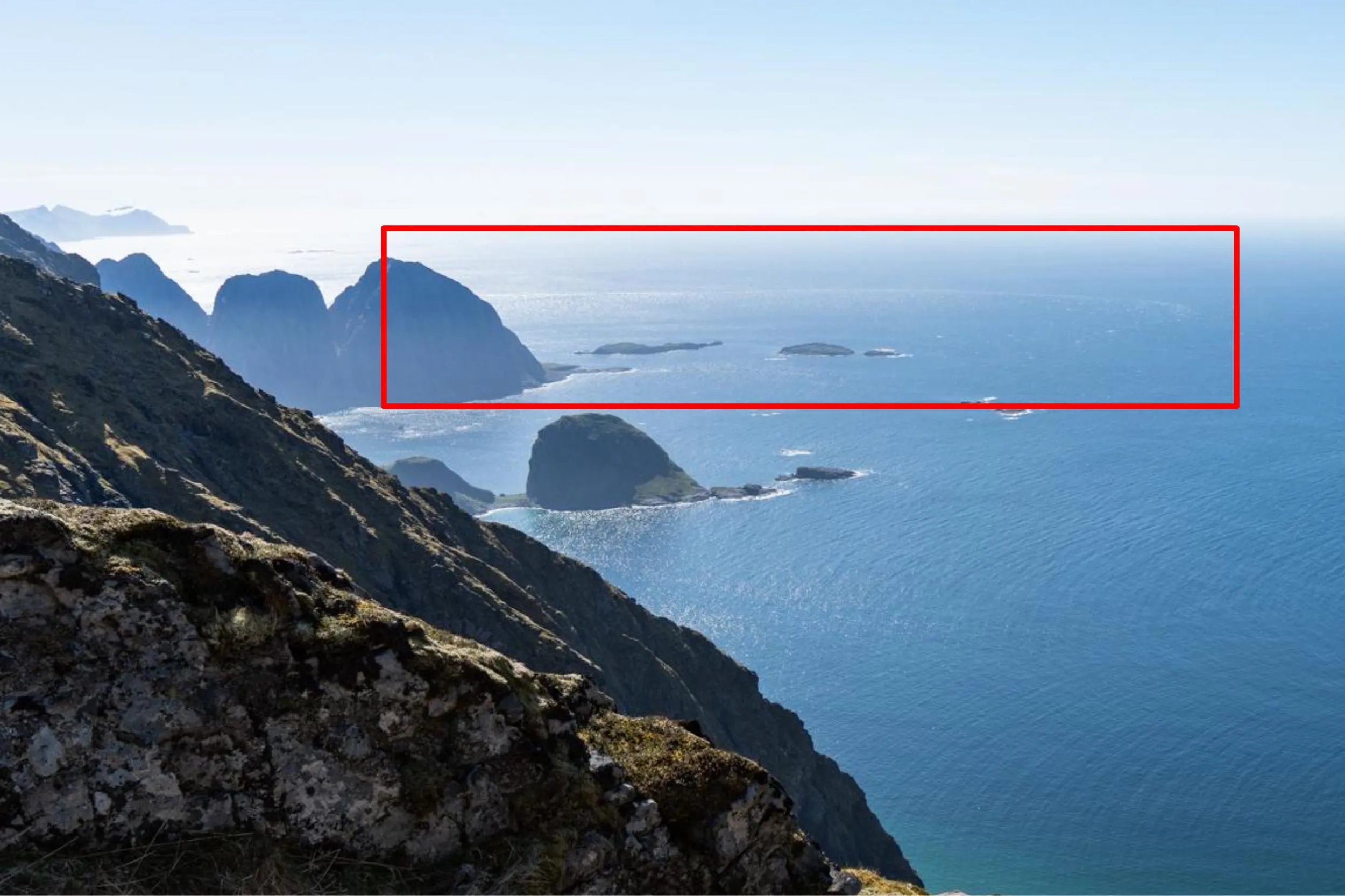
Looking more closely at the water, I noticed a strong current pulling perpendicular to the beach. About half a mile away in the open ocean, I saw a long ring of whitecaps arching toward Hellsegga, near the western tip of the island. We were lucky to have topped out on Ågvatnet Pass during peak ebb flow. The disturbances I was seeing on the water were the Moskstraumen maelstrom at its peak. From my estimate, those whitecaps were 6–10 ft standing waves, which this maelstrom, one of the most powerful in the world, is famous for.
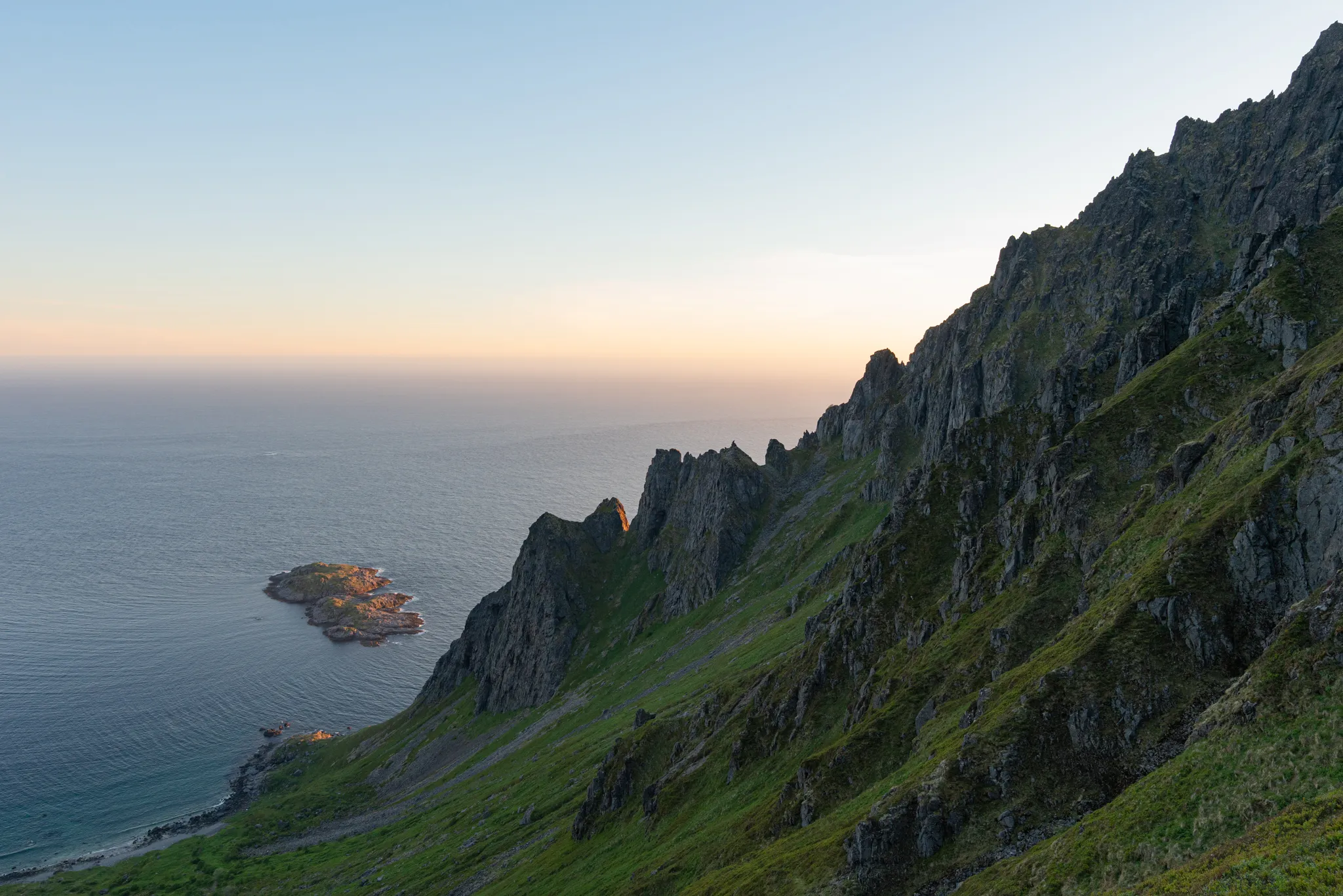
The descent to the white-sand beach of Gjerdvika is extremely steep. There is no trail, so we clung to the hillside, trampling through the moss, shrubs, flowers, and other vegetation that covers it. One unarrested slip could easily lead to a 2,000-foot tumble. Hiking poles are necessary.
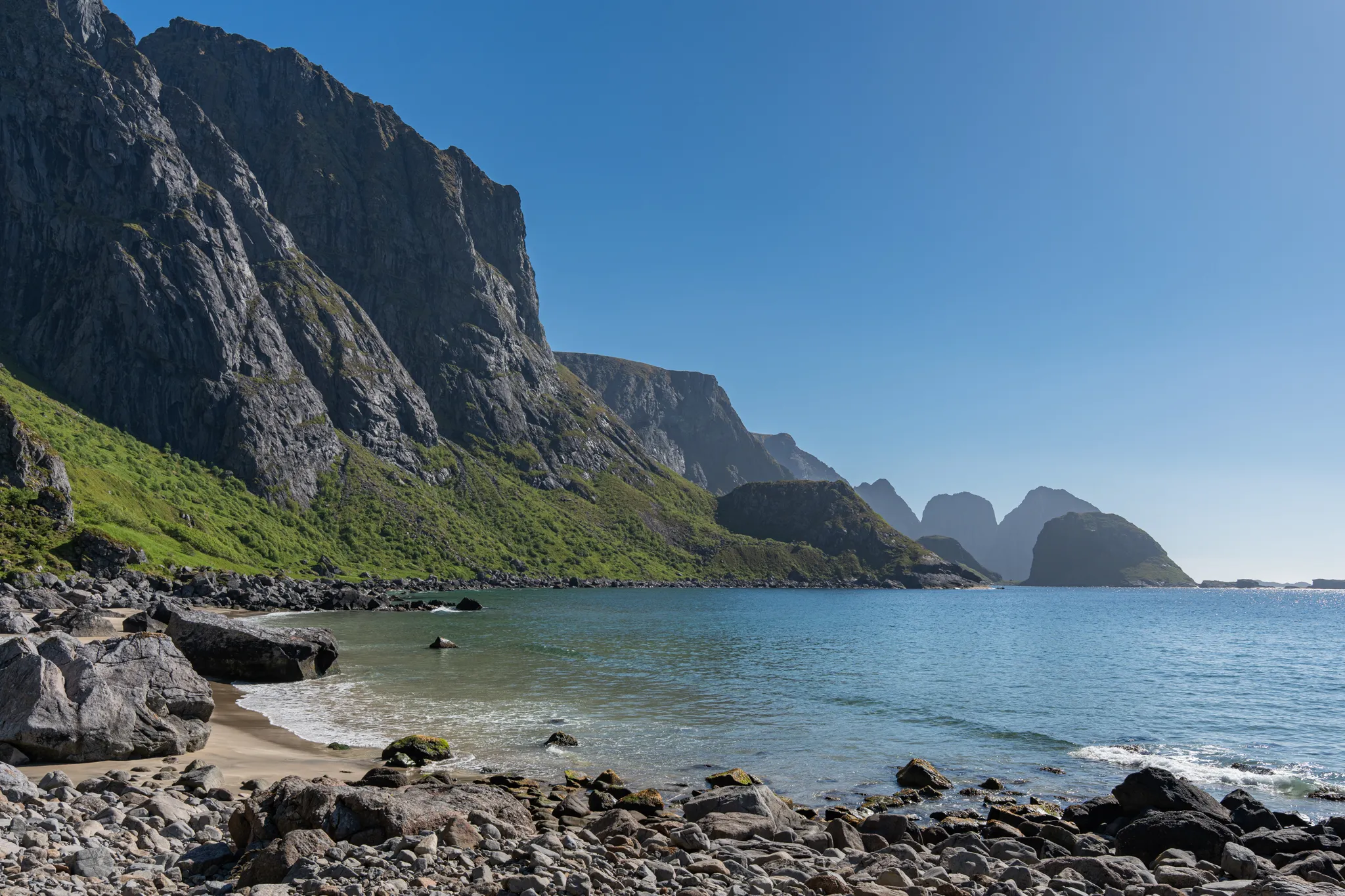
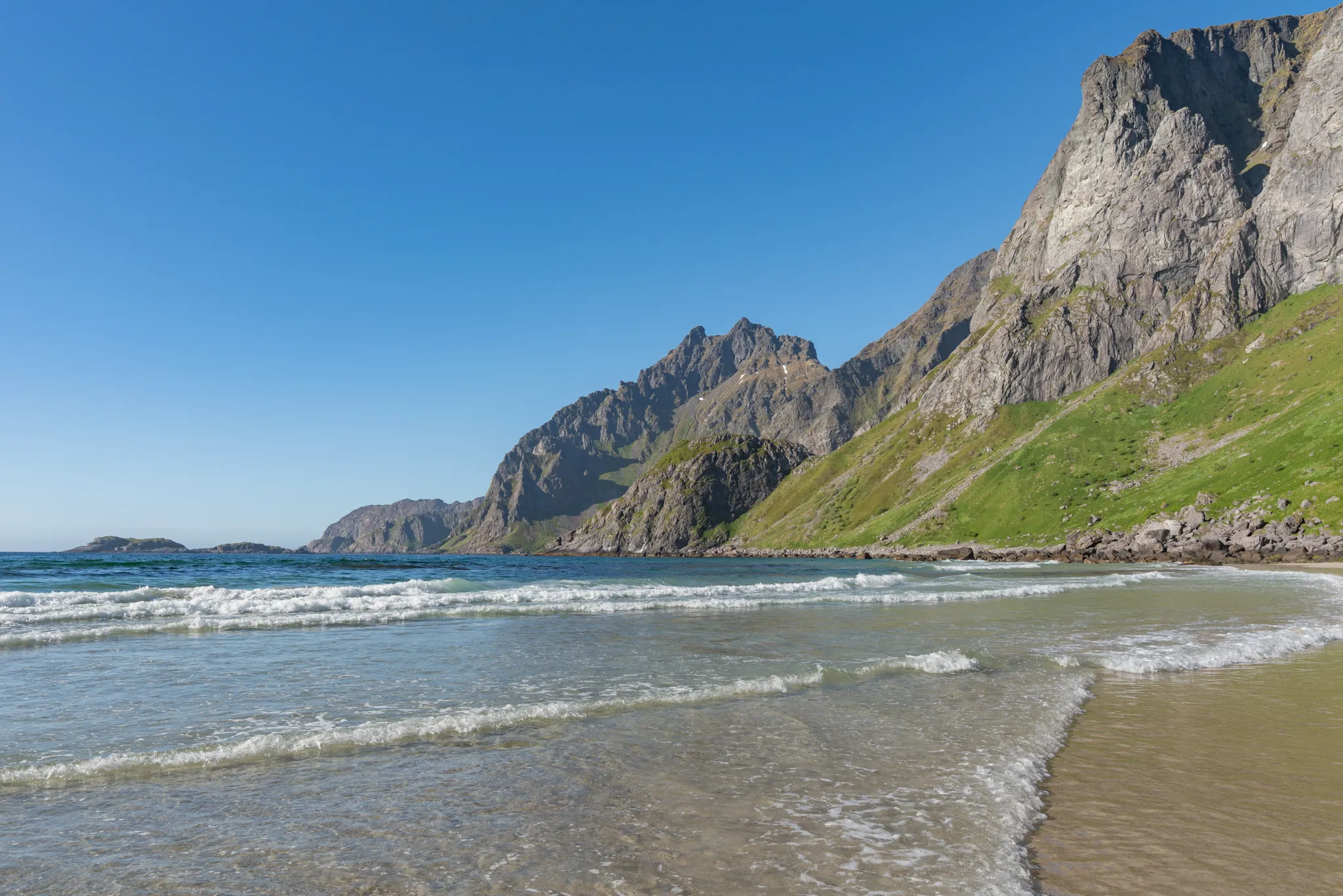
After approximately an hour of careful descent, we were greeted by the soft sand and lapping waves of Gjerdvika. After approximately __ hours of hiking, a barefoot walk in the ~50°F ocean water was the best remedy for our swollen feet. Importantly, the west side of Moskenesøya has no reliable surface water. There are no flowing streams, no waterfalls off the cliffs, and no snowmelt, since the slopes were already baked snow-free by the sun. The only water we found was a spring seeping up through the beach just before it reached the ocean. Keep in mind that this spring on Gjerdvika was the last water source we found.
By this point we were tired, hungry, and already talking about the return to Å. One of our members had sat this trip out with an injury, so he was in town with the car. We figured we’d be back around 11 pm, well after every store closed, so we did the only reasonable thing: we used our satellite phone to ask him to grab us hot dogs from the Circle K. Not my proudest use of a sat phone. Then we realized we’d forgotten condiments, so we sent a second message for ketchup and mustard. We also decided to splurge on a hostel that night, so a soft bed would be waiting for us back in Å.
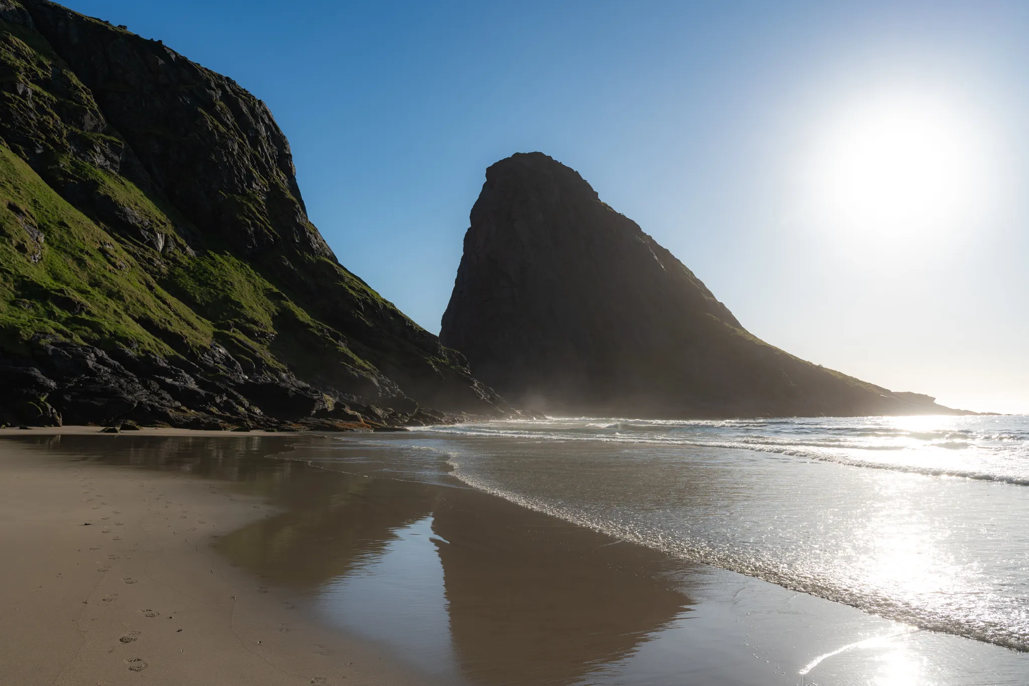
From Gjerdvika, we followed the beach as far as we could before bushwhacking up over a small hill to approach Steinberget. The vegetation on this side of the island is remarkably lush: knee-high hillsides of wildflowers and soft, water-filled plants that crunch underfoot instead of the usual prickly scrub, along with groves of rowan and birch. It’s a stark contrast to the mossy, rocky terrain typical of the rest of Lofoten. With white-sand beaches, crystal-clear water, gentle waves, brilliant sun, thousand-foot granite cliffs, and lush greenery, this is a small slice of paradise. Watch out for spiders in the brush, and wear long pants.
Bailing at Steinberget
Steinberget is a large headland, separated from the mainland cliffs by a narrow channel. My GPS track showed a potential path through this channel along the base of the cliffs. This was not the case: the tide was high and had covered the path. We attempted to bushwhack around instead, sidehilling across the steep slope above a ~100-foot cliff band that dropped straight into the crashing waves. This quickly became treacherous, as the ocean spray had coated the rocks and vegetation in a slick sheen of water. This is a no-fall zone: one slip would send you over the cliff band onto the rocks below. At this point, we decided not to go any further. The sidehill was too steep and the risk of a fall too great.
Golden Hour
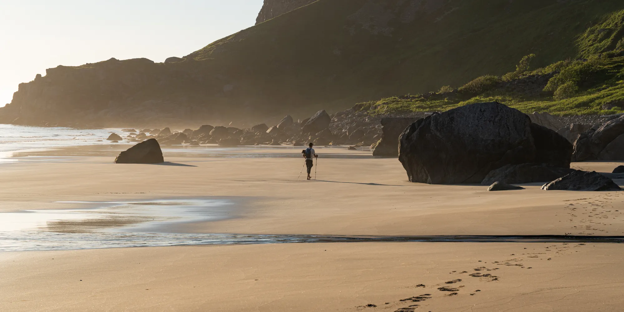
After the decision to bail, we backtracked across the hillsides and beaches to the base of Ågvatnet Pass. We were dehydrated, fatigued, and likely underfed after finishing the Long Crossing the day before. As the midnight sun drifted lower along the horizon, we entered golden hour. Four years earlier, I visited Stockholm during Midsummer, under the same endless summer light. My sister and I both remember a spiritual buzz in the air, like a ringing in the back of your head. In this moment, knee-deep in the brush, surrounded by granite cliffs, and staring into the glowing golden ocean, I felt that same buzz. They say golden hour is when the line between the physical and spiritual realms blurs. In Scandinavian folklore, Midsummer is when the veil between the human world and the hidden folk, the elves, trolls, and huldra, grows thin. I don’t believe in God or in myths, but what I felt walking through the brush that day is indescribable.
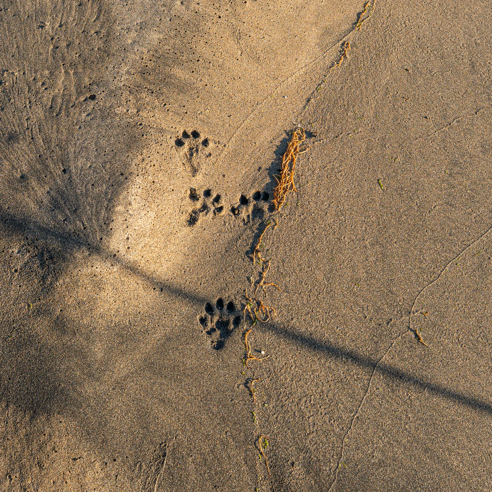
On our way back, we found a lone set of pawprints in the sand. They meandered between the waves and the brush, disappearing and reappearing before finally vanishing into the woods. It seemed ordinary at first, until you remember that Lofoten has no wolves. And why just a single set of prints? Since the prints sat below the high-tide line, they were made recently. A sensible person would say a red fox, or maybe an otter. I prefer to believe it was Fenrir, chained by the gods on a remote island at the edge of the world until Ragnarök, pacing the far side of Moskenesøya beside the maelstrom. As the midnight sun swings back up into the new day and golden hour fades, the rising tide will reclaim the sand and wash Fenrir’s tracks away. The veil between the human world and the hidden folk will close again, and whatever I felt walking through the brush that evening will go with it.
Ågvatnet Pass, Part 2
With golden-red light washing over the cliffs around us, we climbed the steep backside of Ågvatnet Pass. A brutally steep half mile brought us back up to 2,000 feet. From there, we took in the views and prepared for the descent down the couloir. I took the lead on the descent to scout the route and kick away any loose rocks that posed a slip hazard. As I clung to the fixed rope in an improvised rappel, a huge gust of wind blasted up the couloir, raining debris and dirt on me. We descended one by one, making sure the others were clear of the main rockfall path. The couloir is lined with scree and loose dirt, so debris will fall on the descent. Helmets are a necessity.
After descending the couloir, we zigzagged our way down to the basin below Ågvatnet Pass, careful not to trigger a talus slide. From there, we backtracked along the game trail to Ågvatnet Lake.
Getting Tilted in the Bog
We had been hiking for around 18 hours at this point. We were exhausted and sick of granola and dried food. This is the point in every trip where this group of lifelong friends goes totally nonverbal. In my hurry to get back to the hostel, I took a wrong turn and led everyone on a muddy, slippery detour around the far side of the lake. It would have been a nice scenic route if we all weren’t seething with rage. The detour added about 2 miles and dumped us out at a different trailhead, roughly half a mile from the hostel. We walked the last stretch of road in silence and found the hostel. Our support friend was already asleep, and none of us knew where our spare clothes were in the car, so we showered and slept naked under the sheets. I have never fallen asleep so quickly in my life, especially naked under a sheet, one bed away from my friend who was also naked under his.
This was the end of our college grad trip. I will return to reach Hellsegga someday, probably via water taxi, once I have real adult money.